
Trail
River's Edge Trail
About
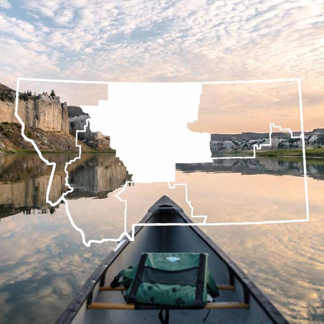
River’s Edge Trail offers an unparalleled outdoor experience to residents and visitors of Great Falls. Fifty-eight miles of trail along both sides of the historic Missouri River provide spectacular views of parks, the river canyon, hydroelectric dams, reservoirs, waterfalls and the prairie. Waterfowl and other wildlife abound. Rest areas are plentiful and locales of interest, such as Giant Springs Heritage State Park and Fish Hatchery and the Lewis and Clark Interpretive Center, dot the way.
The award winning River's Edge Trail is Montana’s premier urban trail network and offers the perfect setting for walking, biking, skating or jogging. Along the trail you will find many opportunities for sight-seeing, picnicking, bird watching, fishing and retracing the steps of Lewis and Clark. Extensive paved urban trails link with parks, museums, waterfalls, dining options, riverfront attractions and downtown Great Falls. Numerous trailheads provide convenient access to the trail on both sides of the river. Trailside art, benches, picnic tables, shelters, rest rooms, and mileage markers all enhance the trail experience. You can look down at Great Falls through a free telescope at the Warden Park Gazebo or gaze up a historic waterfall from Black Eagle Memorial Island.
Paved urban trails make up about 1/3rd of the 58 mile trail and include a 3.5 mile loop along the Missouri River in the heart of the city which passes through West Bank, Elks Riverside Parks, and the Dog and Skate Parks. The paved portions of River's Edge Trail are all wheelchair accessible. Further east are unpaved single track trails which run along both sides of the river east of town.
The 29 miles of single track trails located on both sides of the Missouri River east of Great Falls are one of Montana’s top mountain biking destinations and a favorite of hikers, bikers and trail runners. Separate well marked technical loops on both sides of the river are built to IMBA standards. Please do not use these trails when the ground is wet.
The North Shore single track trail, which runs between Rainbow Dam and Morony Dam, hugs the rugged canyon walls, winds through native bluffs and coulees and offers stunning views of the reservoirs, cliffs, and surrounding mountains.
The South Shore single track trail, runs along the reservoirs from Crooked Falls past the scenic Ryan Dam overlook to the Box Elder Creek canyon, and offers a variety of routes for different skill levels. The most technical trails, known as "Mayhem", are located closest to the river.
Stop in at the Park & Recreation Department on 1700 River Drive N. and pick up your free full color fold-up map of urban and rural River's Edge Trail. Maps are also available at the GF Visitor Center, Bighorn Outdoor Specialists, and other outdoor equipment stores. You can also view and download the map at www.thetrail.org and check out an updated list of fun events on the trail. Got cabin fever? Got friends and family coming? Get your map and go discover your favorite stretch of River's Edge Trail.
Local and state Conservation Districts recently funded 7 panels along the trail which provide information on wetlands, shore and water birds, habitat, local floods, early railroads, aquatic invaders and the role of Conservation Districts. These join 20 other panels along the trail, island and river overlooks.
River's Edge Trail is managed and maintained by the Great Falls Park & Recreation Department and Montana State Parks, with support from the River’s Edge Trail Foundation. If you would like to know more about the 26-year history of River's Edge Trail, current and upcoming trail projects and how you can help make them happen, visit www.thetrail.org
Contact
MAILING ADDRESS
PO Box 553
Great Falls, MT 59403
Great Falls, MT 59403
CONTACT
406-771-1265
Details
SPECIAL DIRECTIONS
River's Edge Trail is located on both sides of the Missouri River through the city and along the reservoirs east of Great Falls.
The south shore trail is served by three paved trailhead parking areas along River Drive and three more along Giant Springs Road. The north shore trail has trailhead parking areas at Rainbow Dam, Ryan Dam and Morony Dam. Two more trailheads serve the urban West Bank Park section of the trail. Free maps are available at www.thetrail.org, the Chamber of Commerce Visitor Center, Park & Recreation Department, Giant Springs State Park Headquarters/Visitor Center, Lewis & Clark Interpretive Center, Bighorn Outdoor Specialists, and other outdoor equipment stores.
SERVICES
Handicapped Accessible
Interpretive Display
Maps
Parking
Pets Allowed
Picnic Shelter
Public Restroom
Trail
Water
ACTIVITIES
Bird Watching
Fishing
Hiking
Lewis And Clark
Mountain Biking
Photography
Picnicking
Sightseeing
Wildlife Viewing
See what's nearby
Filter:
Show All
Where To Stay
Things To Do
Food And Drink
Grid View
List View

3-D International Restaurant and Lounge
Fine Dining
Black Eagle, MT
909 Apartment
Vacation Home
Great Falls, MT
Airway Motel
Hotel/Motel
Great Falls, MT
Alamo/National Car Rental
Car Rental
Great Falls, MT
Alberta Motel & Annex
Hotel/Motel
Great Falls, MT
Apothecary Drug Store
Specialty Store
Great Falls, MT
Austin Designs
Specialty Store
Great Falls, MT
Avis Rent-A-Car
Car Rental
Great Falls
Baskin Robbins
Ice Cream/Yogurt Parlor
Great Falls, MT
